Guwahati: Indian Institute of Technology Guwahati is going to collaborate with Assam Survey and Settlement Training Centre to promote the training of ASSTC officers.
IIT Guwahati will conduct courses related to drone operation, training, maintenance, data collection, application in various sectors, theory classes on modern land management, and Research and Projects by leveraging their respective expertise in this area. It is the first instance across the country where training on drone technology will be imparted to all levels of officers and it is a unique step to integrate knowledge-based technological advancement as part of the training curriculum for state officials.
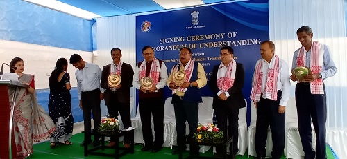
An MoU was signed today (May 4, 2022) between the two institutions in the presence of Shri Jogen Mohan, Hon’ble State Minister Revenue and Disaster Management, Shri Shantanu Gotmare, IAS, Director of Land Records and Surveys, Assam, Prof T. G. Sitharam, Director, IIT Guwahati, Shri Pankaj Chakravarti, Principal, ASSTC and Joint Director Assam Survey and other officials from ASSTC and faculty from IIT Guwahati.
Within the framework of this MoU with ASSTC, IIT Guwahati will impart training to the Government Administrative and Technical staff in Survey and Settlement as well as to private candidates. Both ASSTC and IIT Guwahati will work closely to collaborate and co-operate with each other to support the needs of ASSTC Govt. of Assam officers and select manpower, as mentors, trainees, and skill development and upskilling.
The duration of course work (both practical and theory) will be of one week for Recorder’s Certificate Class Course (RCCC) students and 4 days for officer’s class including one examination/submission of project report/presentation at the end of the session conducted by IIT Guwahati.
For Assam and the Northeast being vulnerable to various natural calamities such as floods, landslides, land erosion by rivers, huge fires, the drone-based technologies can be extremely useful for land survey, river mapping, forest cover, agriculture sector, highway/traffic monitoring, border surveillance, etc. by providing real-time information and data at a time scale not possible manually or by other means.
Click Here for More Science & Technology